Saltburn by the Sea (19/11/2020)
Minolta X-300, Photax Super Paragon 28mm Lens
Lomography Colour Negative 400
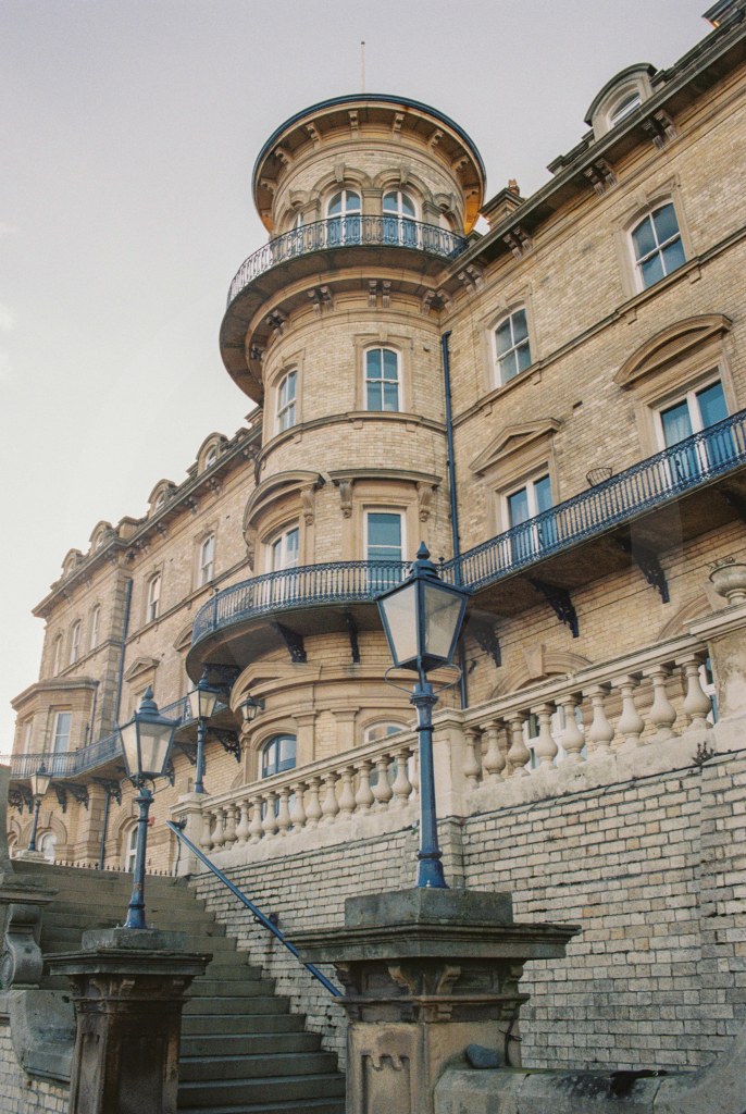
Foundations were laid for the Zetland Hotel on 2nd October 1861. It was one of the first purpose built “railway hotels” (but not the first) and this grand building is now converted to flats. Faced with the distinctive light Pease firebricks this building was planned to be the jewel in Saltburn’s crown, it certainly is that! It’s an imposing and distinctive building.
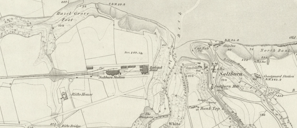
On the OS Map published in 1856 we see that the station, hotel and railway lines are added, along with a wireframe of I assume as part of some sort of “plan” for Saltburn, as none of these things would have existed when this map was surveyed in 1853.
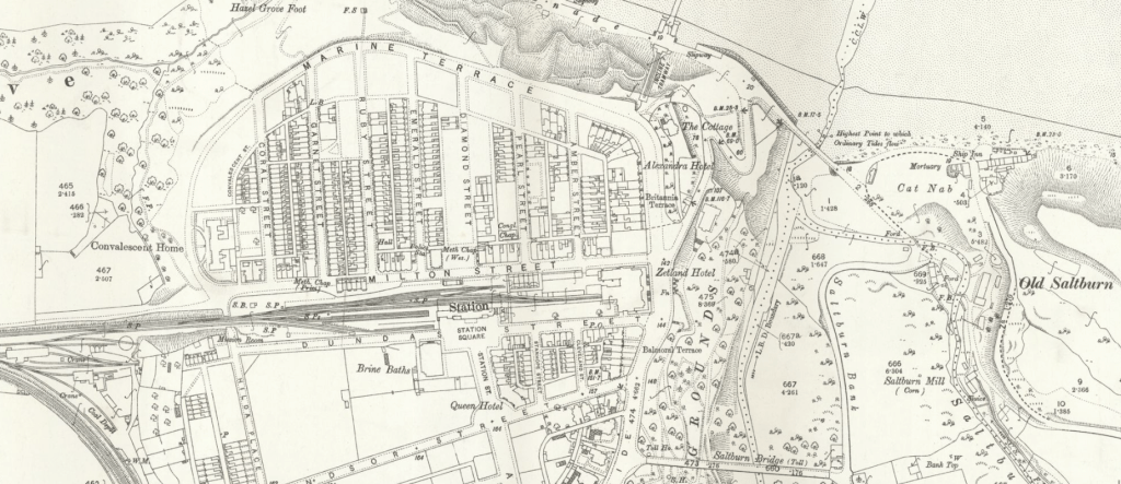
A later map published in 1894 shows the fulfilment of Pease’s prophetic vision of Saltburn.
The Zetland Hotel’s architect William Peachey was employed by the North Eastern Railway, he designed/worked on other buildings in Saltburn these include; Alpha Place, Saltburn Water Tower (in 1865) which was demolished in 1905, Saltburn Railway Station with it’s magnificent portico (started in 1861), Zetland Mews (started in 1861) and “Regent Circus” (the area around Station Square and Windsor Street at the turn of the century). Sadly only one side of the Regent Circus was ever completed.
Despite having an obvious flare for design Peachy was, throughout his career, followed by rumours of financial discrepancies and it has been said he was known for taking “backhanders”. His business links which helped his rise to greatness were also his undoing it would seem.
Another photograph from down the back of Acklam Road…
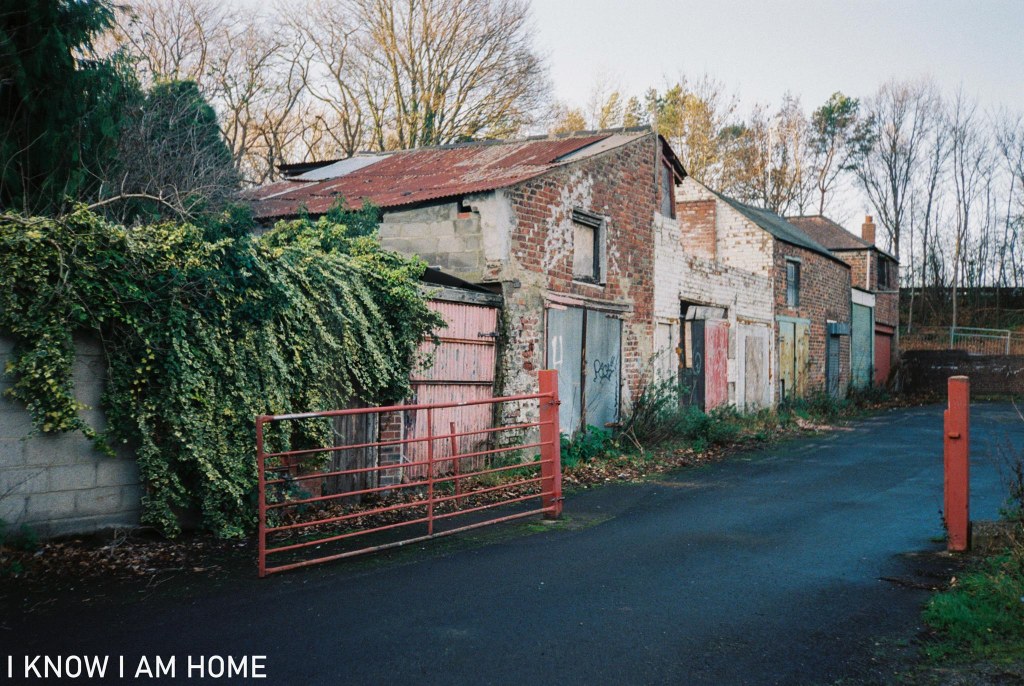
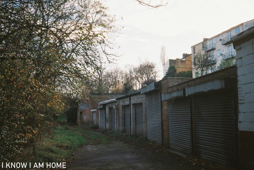
To the rear of Acklam Road, by the old River Tees there’s a collection of sheds and buildings. Some in use, some not.
Some old, some look newer. Waterside buildings here appear on maps from the 1890’s, and the above selection are certainly on maps published in 1915. These are near the Harewood Pleasure Gardens which can be seen in the background and I believe one of these sheds was used by the gardeners for the park.
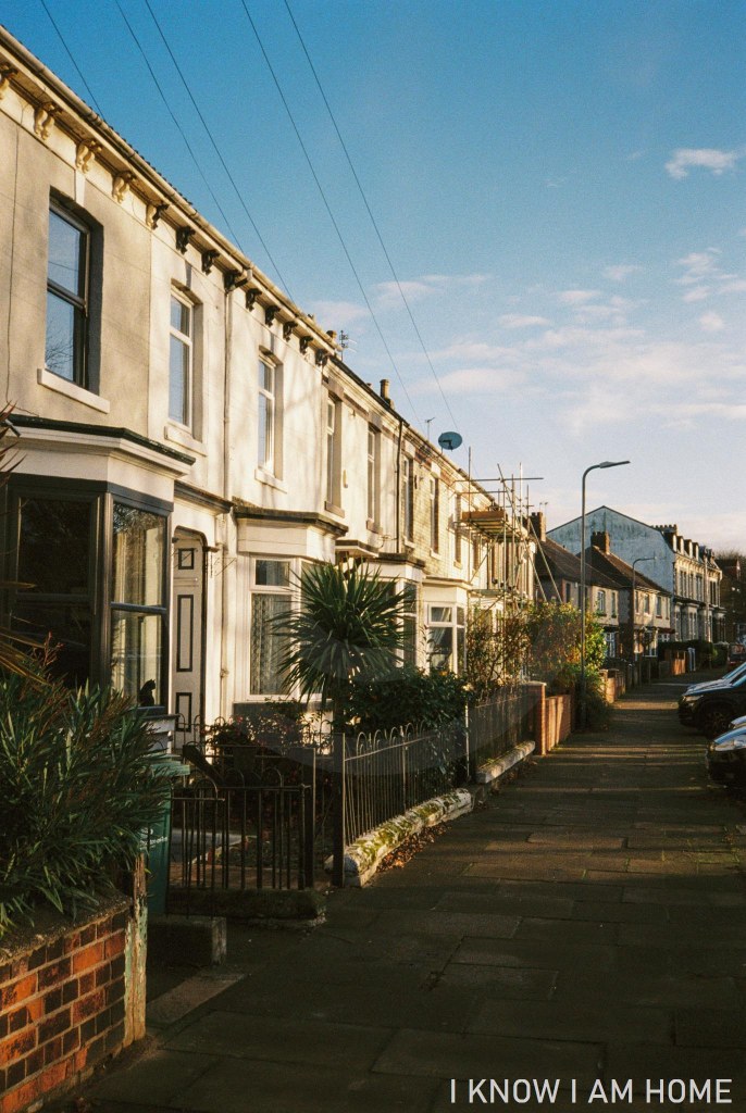
Slightly higher, at the level of Acklam Road are these houses which sit affront the sheds by the old river.
Where Acklam Road curves slightly to the left now if travelling toward Stockton it would have originally carried on past these houses.
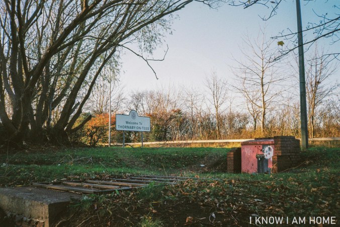
The construction of the A66 meant that Thornaby was in essence cut in two, actually more than that a lot of it was destroyed. The view above would have been quite different, a large building would have been occupying the scene here, with more terrace houses behind and garages and further workshops to the right.
In the above image it’s hard to imagine how just to the left is the old River Tees… Equally difficult to envisage now is the sight of sloops and other coastal craft moored or making the passage to Stockton. One of the reasons this is no longer the course of the Tees is that making passage to Stockton was very difficult, this tidal stretch was said to be riddled with hazards and became silted up regularly.
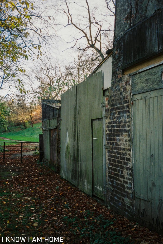
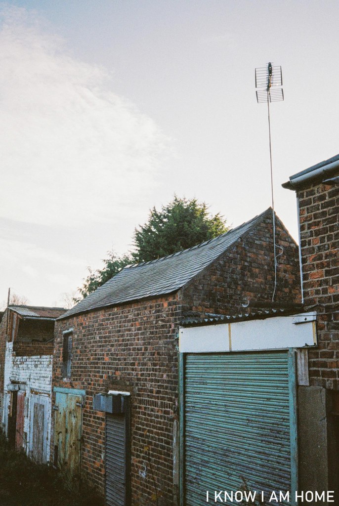
I leave you with an image taken of the buildings closer to the hill back up to Acklam Road, I love the flowing lines of old buildings, in some cases no longer conforming to right angles.
An area over just over 3 acres sits to the east of Acklam Road in Thornaby, this is Harewood Pleasure Gardens.
This land was donated to the people of Thornaby in 1906 by Lord Harewood (Henry George Charles Lascelles, 6th Earl of Harewood), the Lascelles family having links to Thornaby for a number of years, with Francis Lascelles purchasing Thornaby Manor in 1612.
Officially opened in 1909 and a war memorial added in 1921 the gardens were restored in 2008.

There were improvements made in order to compensate for vandalism and a reputation for anti social behaviour.
The park remains a pleasant area for a walk, whatever the weather!