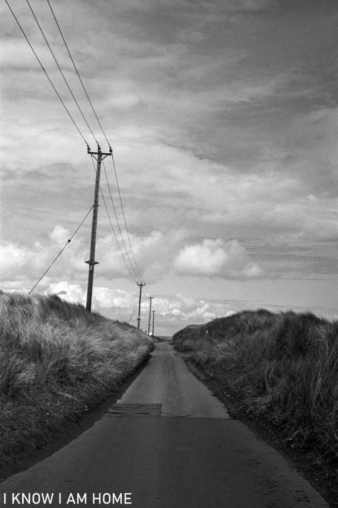
I walked from home to South Gare on the 1st May 2021. Taking photographs along the way. This one was taken before a long traipse through the narrow dune section of the road – because of having to stop to allow cars to pass me safely. I did manage to try this composition which I’ve wanted to for quite some time between cars.
Road to South Gare South Gare, Redcar (01/05/2021) Camera: Olympus OM2 Lens: Olympus OM System Zuiko 50mm F/1.8 Film: Ilford XP2 (shot as ISO 200) Developed In: Compard R09
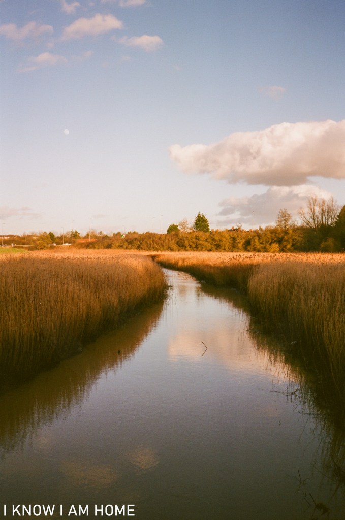
I’m going to post a series of photographic posts looking at what has come to be known as the “Old River Tees” a stretch of what was once (perhaps now unbelievably) part of the River Tees’ route into Stockton, which at the time was a fast developing port.
High Tide The Old River Tees (25/02/2021) Minolta AF-DL Fujifilm Superia Extra 400
The implausibility today (there are still people who I see on my walks along here who are unaware that this was the river, and not just a silted up tidal stream or tributary) is partly why the cut was necessary. The removing of the lengthy loop was initially proposed in the early 1790’s. The “Old Cut” as it came to be known, which was just over 200 yards, was in order to save sailing cargo vessels negotiating the two mile meander of the Tees here.
Low Tide The Old River Tees Chaika II Industar-69 Ilford XP2 Super
Even now without the sheer volume and force of water compared to days before the cut was made the waterway here still silts up, imagine what it would have been like as the tide receded in the days of sail and oar!
My (admittedly poor and not to scale) drawing shows the layout of the river here before the making of the cut. The obvious point being sailors could see the river they were travelling toward despite having to take some two miles of detour to get there. The old cut started and finished either side of the current location of the Tees Barrage. A further cut was made (and seen to the right of the Old Cut in my drawing) to eliminate a shorter meander at Portrack.
Often the vessels would not sail the stretches, rather they’d be hauled by large ropes in a process known as “tracking”, traversing the hazardous tidal stretches, which often became silted up. This not only allowed Stockton to flourish as a port and shipbuilding centre but it meant that the North Riding of Yorkshire acquired the land of the Mandale Marsh’s, which is now occupied by Teesside retail park and the golf course…
This section of the old river, from the tidal structure at the point of the above images to the start of the cut near the Tees Barrage remains fully tidal and is joined by Stainsby Beck (The Fleet).
Despite the clear need for the cut to be made in the Tees it would not be until 1810 however that the cut was completed and the Mandale meander was severed. Mainly due to objections by Lord Harewood, who owned land on the Yorkshire side of the river. He was concerned that his grain mill and associated river-side storage and business would be adversely affected by the change. Compensation was eventually offered and Lord Harewood agreed the cut.
Another cut in the Tees was made close by, known as “New Cut” this one removed a shorter meander which took in much of the land under Portrack Lane’s ASDA / industrial / other retail sites, encompassing the still existent Portrack Marshes.
The deviation of the river meander upstream was at a point under the current A19 Tees Flyover, with the cut being made between that point and a point near to the white water course (with the river originally carrying on as shown above to the Mandale meander). Both of these cuts removed around 4 miles from the river.
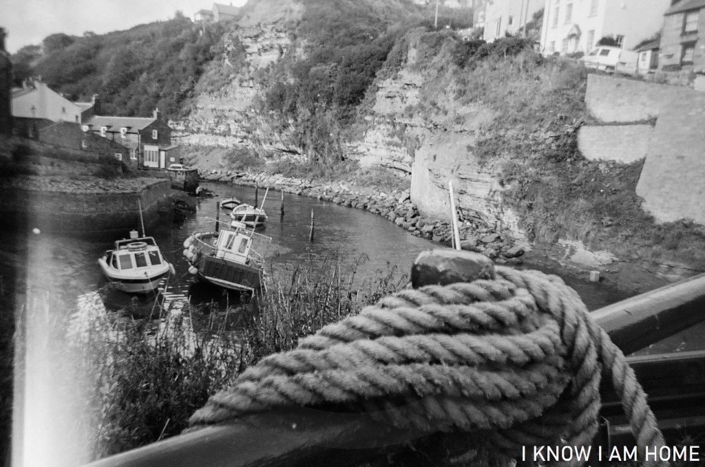
Staithes is a village which quite obviously is intrinsically linked to the sea. Forgetting the mention of Captain James Cook, and his brief apprenticeship in the village, Staithes has been the home and the starting point for many generations of seafarers.
Linked to the sea… Staithes Ilford XP2 Disposable Camera
The image above was taken with a disposable camera, which I like because of the total lack of control. Somehow also a light leak developed on the images, despite the camera remaining a sealed unit until developing. I don’t mind, the images were always meant to be more artistic snapshots than master pieces of technically brilliant photography.
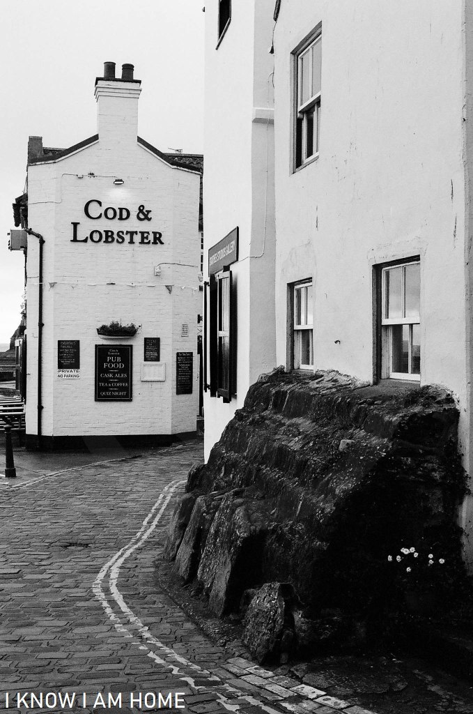
One of the joys of pre-covid volunteering at the museum in Staithes was a visit to the historic Cod and Lobster after the museum closed, a sit with a pint and a meal in good company. The Cod and Lobster, which sits aside the harbour, was damaged in storms in 1953, and has flooded a number of times, whether that be from the sea or harsh weather. The building itself evolving and changing as a result of the sea.
I miss sitting, with a now somewhat alien but comforting bustle of people and conversations merging into one. With walkers, locals, visitors, people I’d just been talking to about this lovely village in the museum. All taking in the sights of the pub, resting after a walk along the Cleveland Way, awaiting the fine reasonably priced food brought to the table.
You eat, taking in different and beautiful views from each window.
You leave, pre-covid of course, through whichever door you please, if the weather is grim through the door which opens out to the narrow road, and wander back through the village…
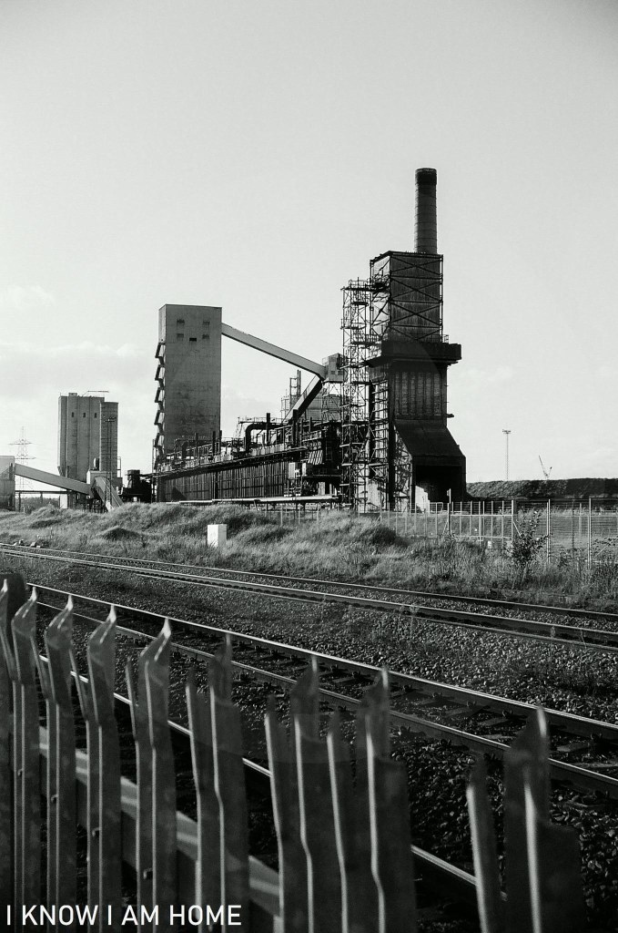
Built around 1880 the Navigation Inn sits at point which was once a hive of activity, related to the port at Cargo Fleet. The building is attractive with it’s symmetrical design. However not a lot is actually written about it’s history. This is one of the many places in Teesside where I often wonder about the stories that the building could tell if it could talk…
Tiled Façade The Navigation Inn, Cargo Fleet Middlesbrough (04/11/2020) Minolta AF-DL Ilford XP2 Super
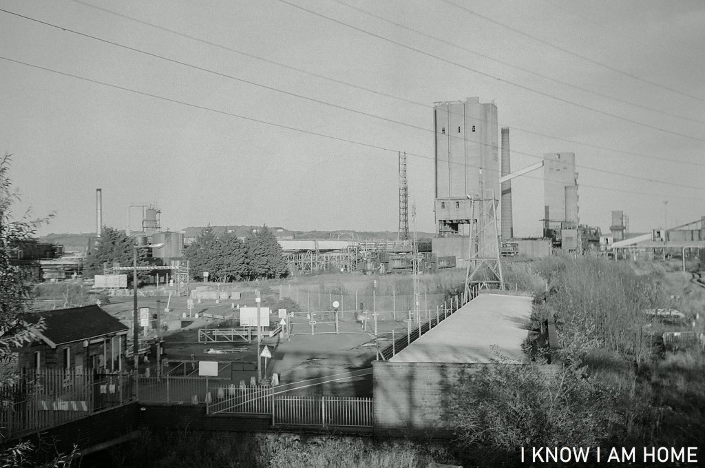
Now it stands somewhat isolated, at the back of a large new(ish) retail until, a railway line adjacent (with a soon to be closed signal box) and perched aside Ormesby Beck.
Free The Navigation Inn, Cargo Fleet Middlesbrough (04/11/2020) Minolta AF-DL Ilford XP2 Super
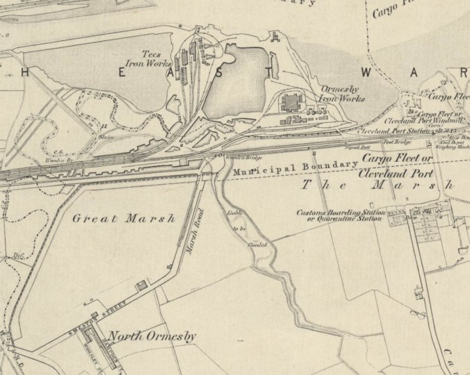
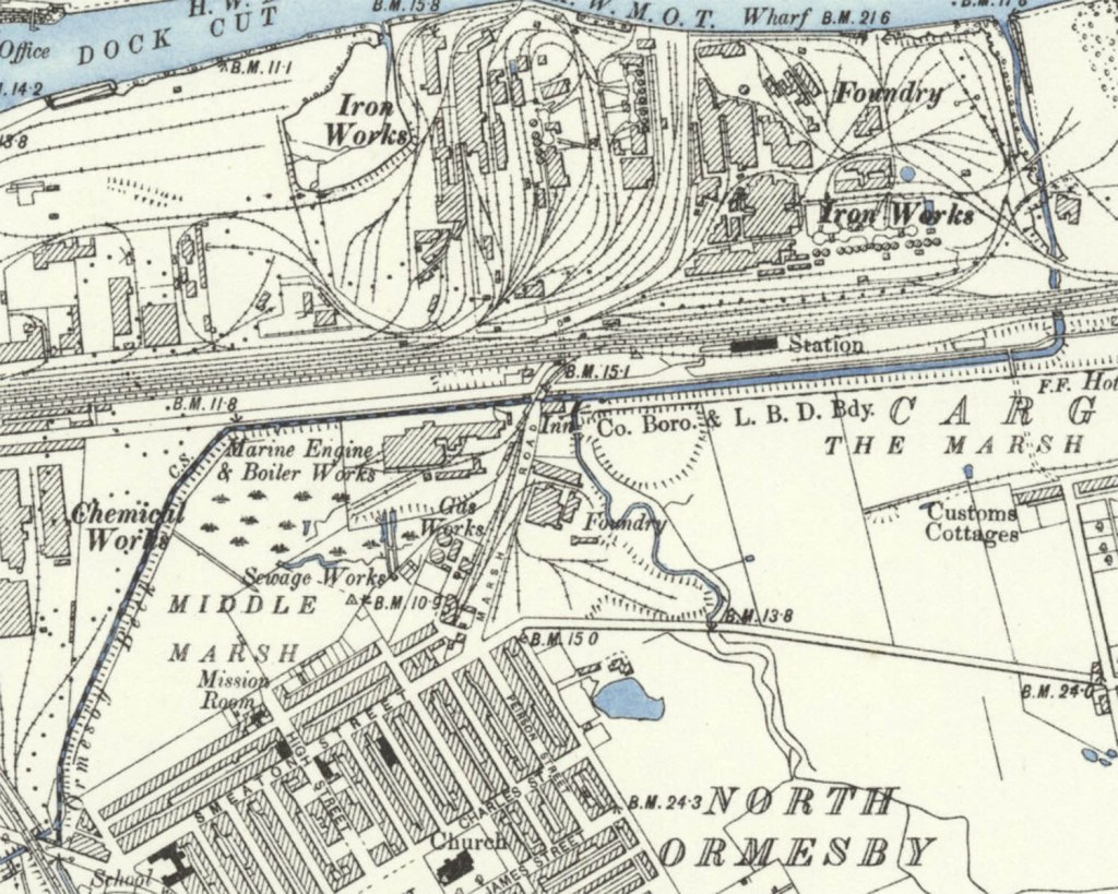
The change in this area of Middlesbrough was enormous. The below map is the Cargo Fleet area as surveyed in 1853.
Reproduced with the permission of the National Library of Scotland, under the Creative Commons Attribution-NonCommercial-ShareAlike 4.0 International (CC-BY-NC-SA) licence.
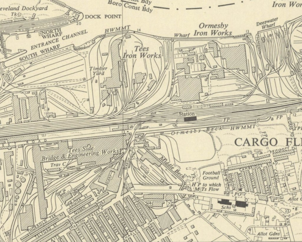
The land around Marsh Road and the area marked as Great Marsh is empty. However moving on to the map surveyed in 1892 not only do we see the Navigation Inn appear but also the marsh area being reclaimed.
Reproduced with the permission of the National Library of Scotland, under the Creative Commons Attribution-NonCommercial-ShareAlike 4.0 International (CC-BY-NC-SA) licence.
Furthermore the conurbations of North Ormesby have grown, the pub also had a nearby railway station (which closed on 22nd January 1990).
Moving on to a map published in 1955 the area is in boom with industry and dwellings.
Reproduced with the permission of the National Library of Scotland
Naturally, with the de-industrialising of the area the traditional “post-work pint” customers would have dwindled. Like most public houses it has its regulars and with the coming of the Riverside Stadium the pub was busy with supporters (pre-covid).
Ormseby Beck The Navigation Inn, Cargo Fleet Middlesbrough (04/11/2020) Minolta AF-DL Ilford XP2 Super
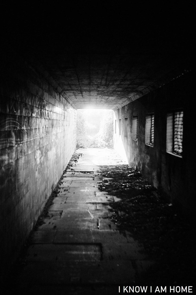
This bit of Ormesby beck runs towards the Tees via a concrete trunking, brutal, hard, forcing the water towards its end.
I stopped off here when walking home from South Bank, the day before the November 2020 lockdown.
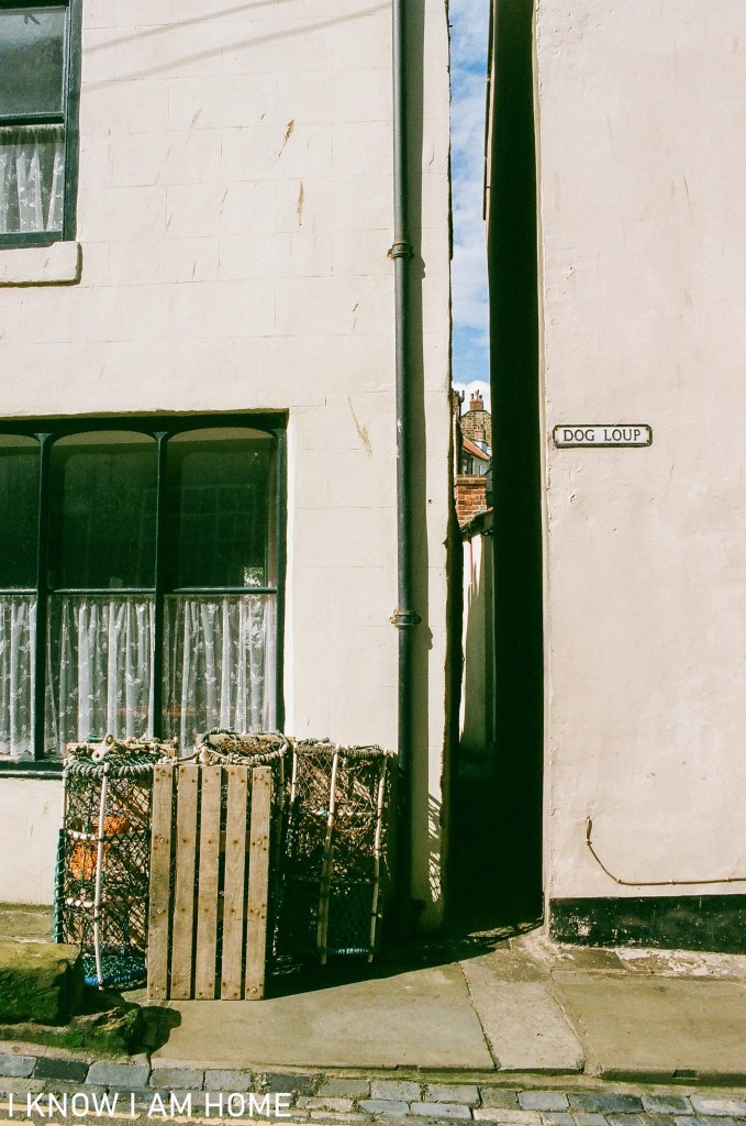
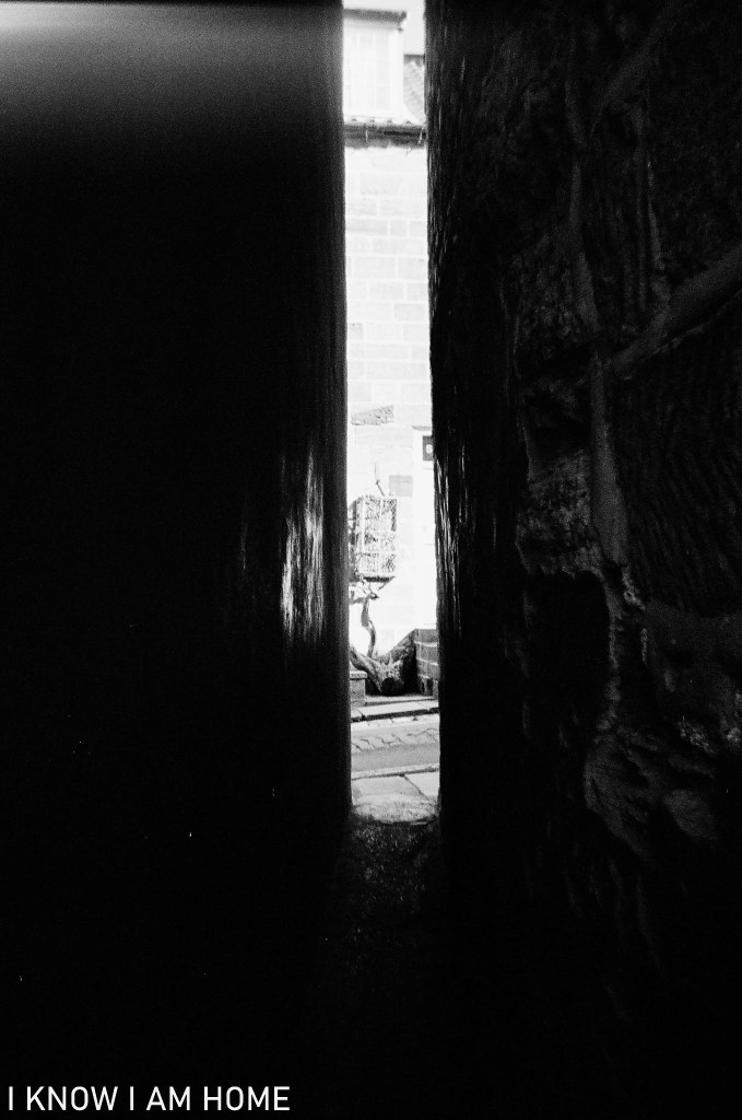
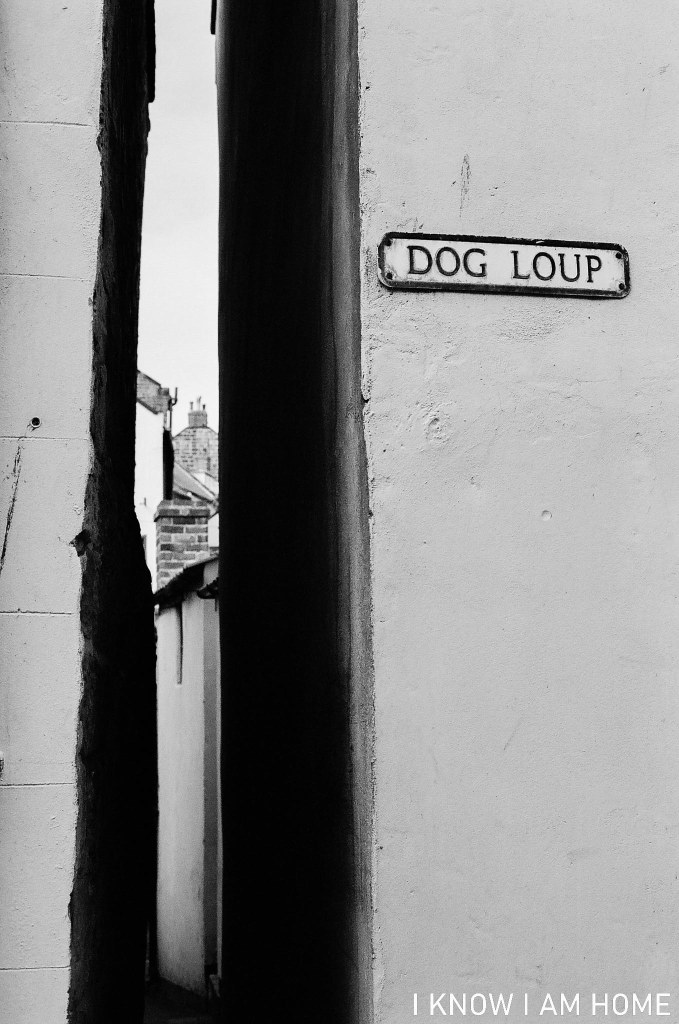
Dog Loup is a narrow passageway between two dwellings in Staithes, taking you from the main Church Street to Gun Gutter, which in turn leads up steps to High Barrass.
Lobster Pot Passageway Staithes Minolta X-300, Photax Super Paragon 28mm Lens Fujifilm Superia X-Tra Colour ISO 400
Myself and a friend have measured the passageway here and found at some points it’s as narrow as 17 inches, however it’s often quoted that 18 inches is the narrowest.
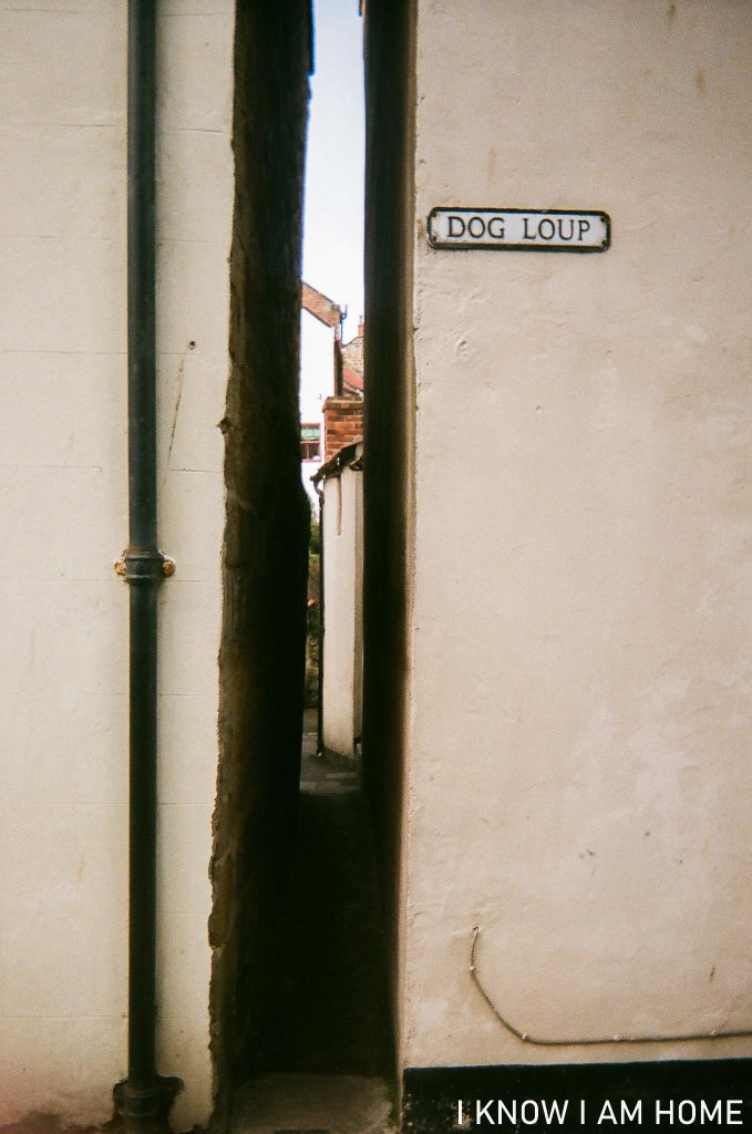
Down pipe, down alleyway Staithes Disposable Camera
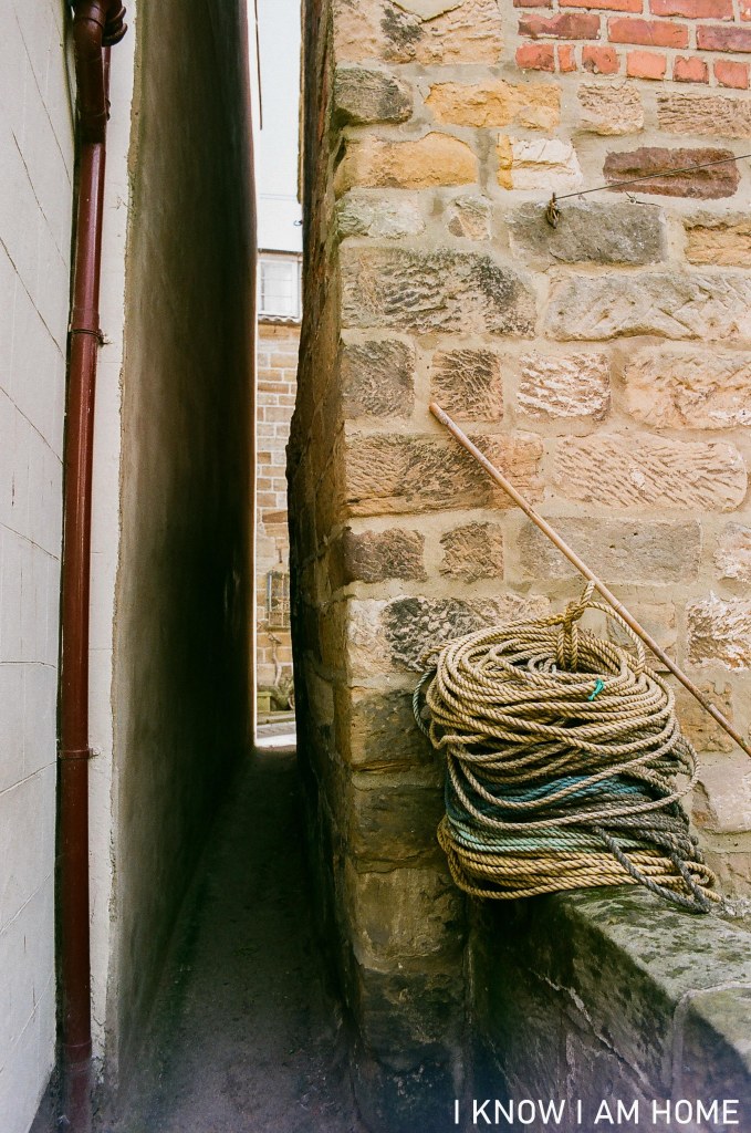
Obviously the usable space for walking differs as buildings are rendered or maintained.
In the midst… Staithes Ilford XP2 Disposable Camera
Sometimes it seems like you couldn’t walk along the passageway. Almost everyone has to shuffle sideways.