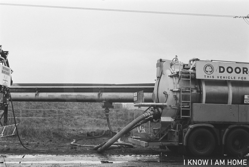
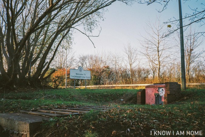
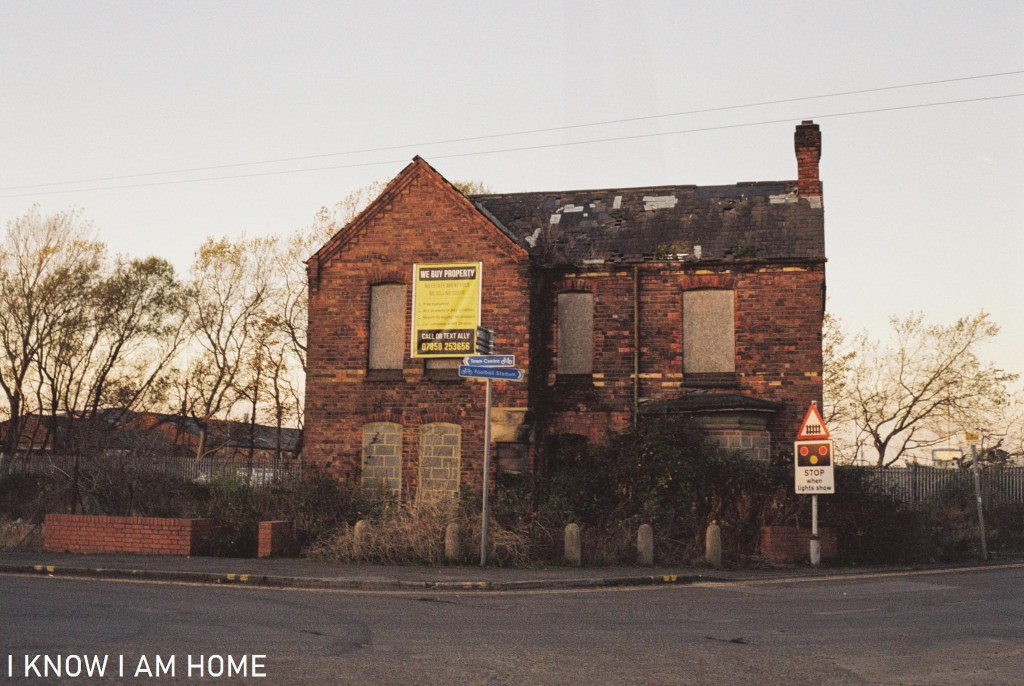
Old Toll Bar

Old Toll Bar
Cargo Fleet Road
(04/11/2020)
Olympus Trip 35
Kodak Colourplus 200

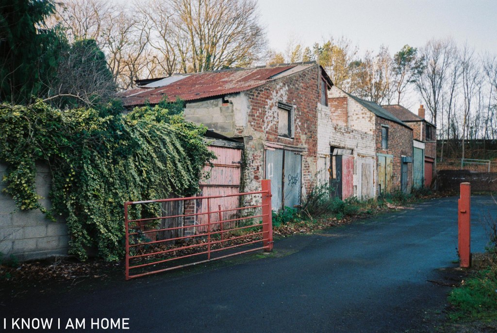
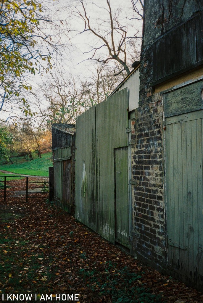
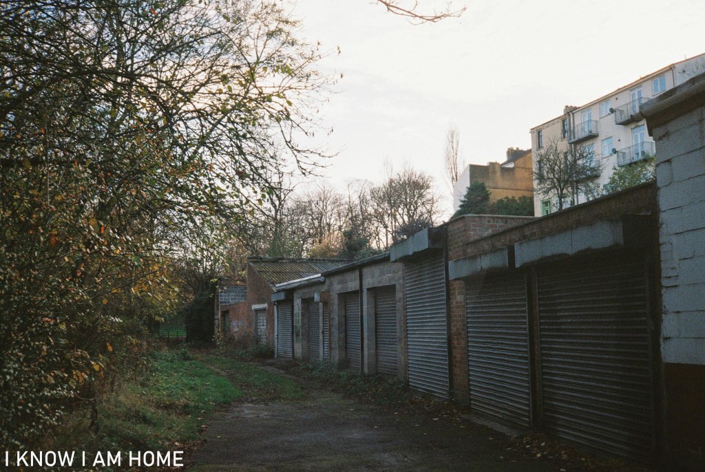
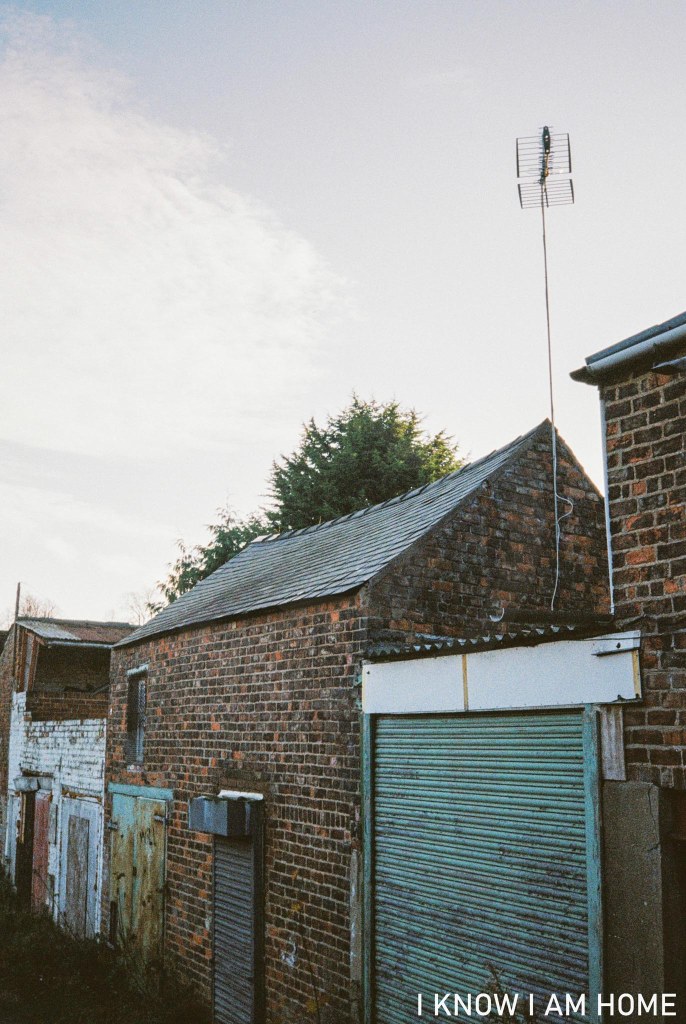
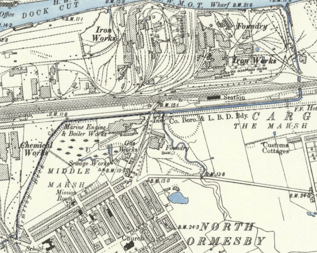
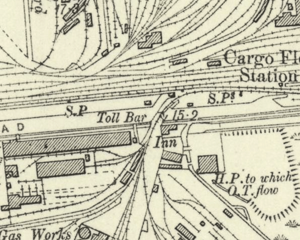
Near by the Navigation Inn and Whitehouse Signal Box, aside the railway line is this delightful looking but dilapidated property. This was a toll bar, which was built around 1854.

Reproduced with the permission of the National Library of Scotland, under the Creative Commons Attribution-NonCommercial-ShareAlike 4.0 International (CC-BY-NC-SA) licence.

The idea of paying a toll to use a road in a town is mostly obsolete these days, however some notable examples of toll roads still exist including the Tyne Tunnel.
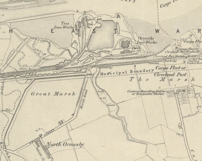
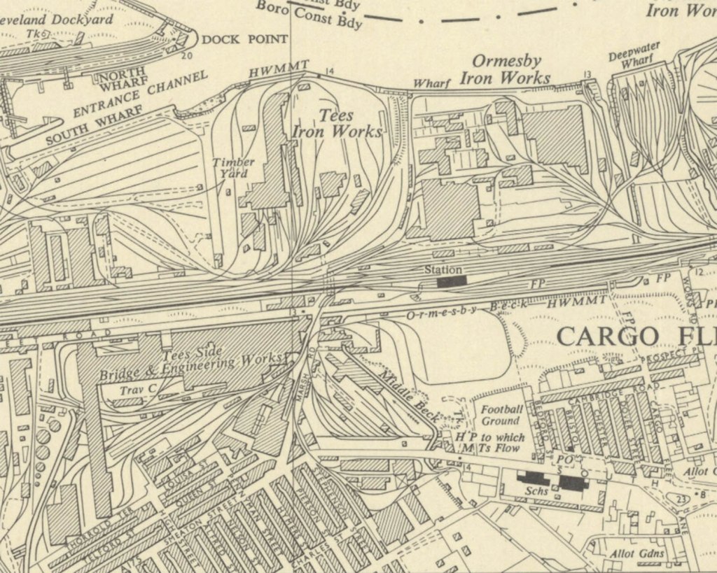
However in Middlesbrough up until 1916 charging a toll for anything other than pedestrians to use a road proved quite lucrative. This toll bar was owned and overseen by Middlesbrough Estates, however others belonged to local magnates such as Mr J W Pennyman or Lord Furness. Cargo Fleet Road is now pedestrianised at the western most end, however in the 1800’s it was a well used route in and out of the town.

Middlesbrough Corporation was keen to do away with tolls for road usage, it was proving quite a encumbrance when it came to moving goods around the town and indeed further afield.

On 31st July 1916 toll roads in Middlesbrough were abolished.

Following this the toll bar here apparently saw use as accommodation for railway workers at the near by Cargo Fleet railway station.

Zetland Hotel, Saltburn

Zetland Frontage
Saltburn by the Sea
(19/11/2020)
Minolta X-300, Photax Super Paragon 28mm Lens
Lomography Colour Negative 400

Foundations were laid for the Zetland Hotel on 2nd October 1861. It was one of the first purpose built “railway hotels” (but not the first) and this grand building is now converted to flats. Faced with the distinctive light Pease firebricks this building was planned to be the jewel in Saltburn’s crown, it certainly is that! It’s an imposing and distinctive building.

On the OS Map published in 1856 we see that the station, hotel and railway lines are added, along with a wireframe of I assume as part of some sort of “plan” for Saltburn, as none of these things would have existed when this map was surveyed in 1853.

Reproduced with the permission of the National Library of Scotland, under the Creative Commons Attribution-NonCommercial-ShareAlike 4.0 International (CC-BY-NC-SA) licence.

A later map published in 1894 shows the fulfilment of Pease’s prophetic vision of Saltburn.

Reproduced with the permission of the National Library of Scotland, under the Creative Commons Attribution-NonCommercial-ShareAlike 4.0 International (CC-BY-NC-SA) licence.

The Zetland Hotel’s architect William Peachey was employed by the North Eastern Railway, he designed/worked on other buildings in Saltburn these include; Alpha Place, Saltburn Water Tower (in 1865) which was demolished in 1905, Saltburn Railway Station with it’s magnificent portico (started in 1861), Zetland Mews (started in 1861) and “Regent Circus” (the area around Station Square and Windsor Street at the turn of the century). Sadly only one side of the Regent Circus was ever completed.

Despite having an obvious flare for design Peachy was, throughout his career, followed by rumours of financial discrepancies and it has been said he was known for taking “backhanders”. His business links which helped his rise to greatness were also his undoing it would seem.

Back Sheds, Cleveland View and Acklam Road

Old Sheds
 Thornaby
(25/11/2020)
Minolta AF-DL
Lomography Colour Negative 400

To the rear of Acklam Road, by the old River Tees there’s a collection of sheds and buildings. Some in use, some not.
Some old, some look newer. Waterside buildings here appear on maps from the 1890’s, and the above selection are certainly on maps published in 1915. These are near the Harewood Pleasure Gardens which can be seen in the background and I believe one of these sheds was used by the gardeners for the park.

Acklam Road
 Thornaby
(25/11/2020)
Minolta AF-DL
Lomography Colour Negative 400

Slightly higher, at the level of Acklam Road are these houses which sit affront the sheds by the old river.
Where Acklam Road curves slightly to the left now if travelling toward Stockton it would have originally carried on past these houses.

Split the town in two
 Thornaby
(25/11/2020)
Minolta AF-DL
Lomography Colour Negative 400

The construction of the A66 meant that Thornaby was in essence cut in two, actually more than that a lot of it was destroyed. The view above would have been quite different, a large building would have been occupying the scene here, with more terrace houses behind and garages and further workshops to the right.

A mix
 Thornaby
(25/11/2020)
Minolta AF-DL
Lomography Colour Negative 400

In the above image it’s hard to imagine how just to the left is the old River Tees… Equally difficult to envisage now is the sight of sloops and other coastal craft moored or making the passage to Stockton. One of the reasons this is no longer the course of the Tees is that making passage to Stockton was very difficult, this tidal stretch was said to be riddled with hazards and became silted up regularly.

I leave you with an image taken of the buildings closer to the hill back up to Acklam Road, I love the flowing lines of old buildings, in some cases no longer conforming to right angles.

Flowing lines
 Thornaby
(25/11/2020)
Minolta AF-DL
Lomography Colour Negative 400

The Navigation Inn

Built around 1880 the Navigation Inn sits at point which was once a hive of activity, related to the port at Cargo Fleet. The building is attractive with it’s symmetrical design. However not a lot is actually written about it’s history. This is one of the many places in Teesside where I often wonder about the stories that the building could tell if it could talk…

Tiled Façade
The Navigation Inn, Cargo Fleet Middlesbrough
(04/11/2020)
Minolta AF-DL
Ilford XP2 Super

Now it stands somewhat isolated, at the back of a large new(ish) retail until, a railway line adjacent (with a soon to be closed signal box) and perched aside Ormesby Beck.

Free
The Navigation Inn, Cargo Fleet Middlesbrough
(04/11/2020)
Minolta AF-DL
Ilford XP2 Super

The change in this area of Middlesbrough was enormous. The below map is the Cargo Fleet area as surveyed in 1853.

Reproduced with the permission of the National Library of Scotland, under the Creative Commons Attribution-NonCommercial-ShareAlike 4.0 International (CC-BY-NC-SA) licence.

The land around Marsh Road and the area marked as Great Marsh is empty. However moving on to the map surveyed in 1892 not only do we see the Navigation Inn appear but also the marsh area being reclaimed.

Reproduced with the permission of the National Library of Scotland, under the Creative Commons Attribution-NonCommercial-ShareAlike 4.0 International (CC-BY-NC-SA) licence.

Furthermore the conurbations of North Ormesby have grown, the pub also had a nearby railway station (which closed on 22nd January 1990).

Moving on to a map published in 1955 the area is in boom with industry and dwellings.

Reproduced with the permission of the National Library of Scotland

Naturally, with the de-industrialising of the area the traditional “post-work pint” customers would have dwindled. Like most public houses it has its regulars and with the coming of the Riverside Stadium the pub was busy with supporters (pre-covid).

Ormseby Beck
The Navigation Inn, Cargo Fleet Middlesbrough
(04/11/2020)
Minolta AF-DL
Ilford XP2 Super

This bit of Ormesby beck runs towards the Tees via a concrete trunking, brutal, hard, forcing the water towards its end.

I stopped off here when walking home from South Bank, the day before the November 2020 lockdown.